Life on the land was often hard. The farms to the south of Dorking were cultivated with difficulty. Oxen struggled to plough the clay which was waterlogged in winter and baked hard in summer. To counteract the soil’s acidity, marl from lower layers was dug and spread. Yields were low and when cropped – of wheat, barley, oats or rye – the land needed long periods of rest.
Areas that were not viable for cultivation were known as ‘wastes’. These common lands were vital to the local economy. Without access to the wastes tenant farmers would have been unable to survive. So, although the lord hunted on them and harvested them for charcoal, timber, gravel, holly and turf, he granted his tenants ‘rights of common’ over them – because he relied on his tenants’ labour and beasts to cultivate his own land.
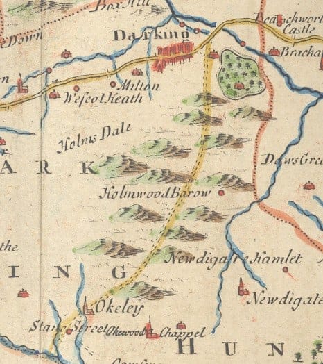
Robert Morden’s map (1695) of Darking

Image : Ploughing With oxen. From the 14th century Luttrell Psalter
Dorking’s largest waste was the ‘home’ wood (now Holmwood). There were smaller wastes at Beare Green, Misbooks Green, Clarke’s Green, Maynack Wood, Ashcombe Heath, Cotmandene, Spital Heath and Mount Heath.
The wastes were vigorously policed. Unauthorized animals were ‘impounded’ – taken off the commons and put into pounds – with fines payable for their release.
Last : Life in Medieval Dorking
Next : Isolation and Religion